 The historic town of Marlborough lies in the Kennet Valley, within the North Wessex Downs National Landscape. To the north and west are the high chalk hills of the Marlborough Downs rising to over 500 feet, with the Ridgeway, a long distance path, running close to the northern edge. On the scarp face of the Downs figures of White Horses have been cut into the hillside exposing the chalk rock.
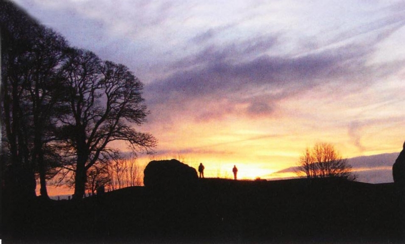
On the Downs there is evidence of human habitation from earliest times. Windmill Hill, near Avebury, is the largest known causewayed enclosure in England and dates from about 3,300 BC. The impressive Neolithic stone circle of Avebury of 2,700 BC predates Stonehenge by about 500 years.
The 17th century antiquarians John Aubrey and William Stukeley are responsible for initiating modern study of the Avebury monument. The detailed plan of the position of the stones, drawn by Aubrey, has proved invaluable for later archaeologists, for it contained reference to many standing stones that would soon after be destroyed by local people.
Many of the large stones at Avebury, like those at Stonehenge, are very hard sandstone, called “Sarsens”. These Sarsen stones are found scattered over the Marlborough Downs and are locally known as “Grey Wethers”, as from a distance they looked like sheep; ‘Wethers’ being the Old English word for sheep. Fyfeld Down is famous for its Grey Wethers and a walk to the Devil’s Den (Dolman) takes in beautiful countryside. Another impressive group of stones can be seen in Lockeridge Dene to the west of Marlborough. The AONB website www.northwessexdowns.org.uk has a new list of walks. The ten easy routes can be reached by bus from the North Wiltshire and Swindon area and take in spectacular landscapes.
Close to Avebury is the West Kennett Long Barrow, signposted off the A4, and Silbury Hill clearly visible from the road; both of which are well worth a visit, although climbing Silbury Hill is not permitted. It continues to be a tantalizing mystery as it is not a burial mound like the many small round Bronze Age barrows in the Marlborough area, but is the largest earthwork in Europe.
The Wansdyke is a long deep linear earthwork to the west and south of Marlborough. A spectacular section at Walkers Hill, above the Vale of Pewsey, can be accessed by a short walk from the car park on the Lockeridge to Alton Barnes road. Today many visitors come in the summer to view the phenomena of “crop circles” which appear on farmland around Marlborough and regular updates are made on www.temporarytemples.co.uk/ Please always seek permission from landowners before accessing them and abide by the Crop Circle Code of Conduct.
William the Conqueror made Savernake Forest a Royal Forest and it was much more extensive in those days, including West Woods to the west of Marlborough. The Royal Forest was administered by a series of hereditary Wardens, frstly by the Esturmys, with this Office passing by marriage to the Seymours. The Seymours lived at Wulfhall on the southern edge of the forest and it was the home of Jane Seymour, who in 1536 married Henry VIII. Jane died soon after giving birth to their son Edward, the future Edward VI. The present Wardens are the Brudenell-Bruce family who can trace their ancestry back to the Conquest.
One of the oldest trees in the forest is the Big Bellied Oak beside A346, south of Marlborough and Cadley. There are many other old and named trees in Savernake; guides and books can be found locally in the High Street. Savernake Forest with its beech, oak, ash and chestnut trees makes a wonderful backdrop to the picnic, barbeque and camping sites which are popular with visitors throughout the year. To book a site ring 0845 130 8224 or go to www.campingintheforest.co.uk

The town of Marlborough nestles in the Kennet Valley, surrounded by downland and forest and can trace its history back to Neolithic times. The area possesses some of the finest surviving Neolithic relics with both Avebury and Stonehenge being World Heritage Sites.
A mile to the east of the town lay the Roman settlement of Cunetio, (now within the Parish of Mildenhall), at the crossing of the roads between Londinium (London) and Aquae Sulis (Bath) and Corinium (Cirencester) and Venta Belgarum (Winchester). Cunetio later became a planned, gridded town with walled defences. It was occupied for about 300 years until it was abandoned in the early 5th century. In 1978, the largest coin hoard from Roman Britain was discovered there. This is now on display in the British Museum.
At the time of the Norman Conquest, a motte and bailey castle was built in what are now the grounds of Marlborough College. It utilised a prehistoric mound which legend says is the burial place of Merlin, King Arthur’s magician. The tradition frst appears in the Sixteenth Century and is refected in the town’s motto: UBI NUNC SAPIENTIS OSSA MERLINI – ‘Where now are the bones of the wise Merlin?’
The Castle was a royal residence, handy for the hunting grounds of the Savernake Forest. This may have been the reason that King John gave the town its frst charter in 1204.
In the days before it established a permanent home, Parliament met wherever the King was in residence. In 1267, the Statutes of Marlborough were passed under Henry III. They deal with the rights of the citizen and are the oldest statute laws that have never been repealed.
In the later Middle Ages, the castle fell into ruins as military technologies made such buildings outmoded and the royal family opted for more comfortable accommodation. The building became a kind of quarry, its stones providing a resource for the townspeople. It is said that the coping on the walls of the graveyard at St Peter’s Church came from the castle. The estate passed into the hands of the Seymour family, who were numbered amongst Henry VIII’s many in-laws.
The town’s importance as a staging post on the road between London and Bristol ensured that it received a number of visits in the 1590s from the Lord Chamberlain’s Men, William Shakespeare’s acting company. A performance in the courtyard of the White Hart Inn (Blue Plaque at Russell Square by the Marlborough & District Conservative Club) would be followed by one before the Mayor and his guests in the Guildhall.
With the outbreak of Civil War in 1642, the townspeople were strongly for Parliament, while the Seymours held the Castle for the King, who dispatched a force under Lord Digby to take the town. When Digby demanded its surrender, the townspeople replied “The King’s Majesty, providing he were attended in Royal and not in war like wise, should be as welcome to that town as ever was Prince to People, but, as to delivering up the good Town of Marlborough to such a traitor as Lord Digby… they would sooner die.” What became known as ‘The Battle of Marlborough’ ensued, fought in the streets, alleys and even the churches of the town. After Digby captured and looted the town, he marched 120 prisoners through the snow in chains to Oxford.


TheWiltshire History Centre, located in Chippenham, has a wealth of resources - it would be easy to spend a day searching through old documents, photographs, maps, newspapers, town council minutes and more, and is a great place to visit if you are researching family or local history. As a taster, there are a number of extracts from The Marlborough Times and Wilts and Berks County paper, dated 11th October 1902, discussing the opening of the current Town Hall on our Town Hall pages.
The Wiltshire History Centre website has a page dedicated to Marlborough.
 Marlborough Town Council











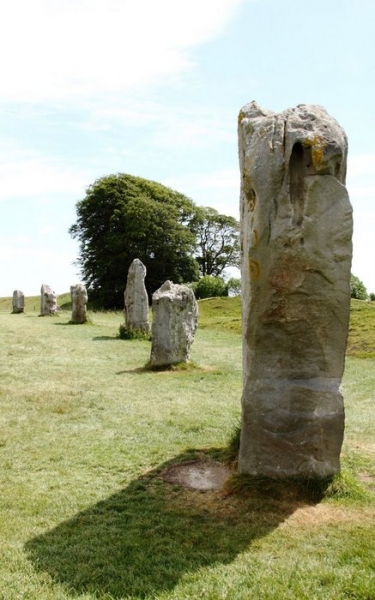 Marlborough has some of the most significant and oldest features of English Heritage on its doorstep. Less than 7 miles away stands the
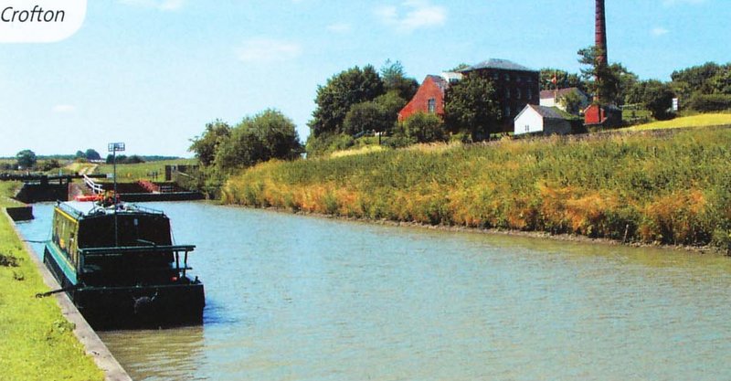 For those who prefer history connected with the built environment, particularly the industrial revolution, other local attractions include: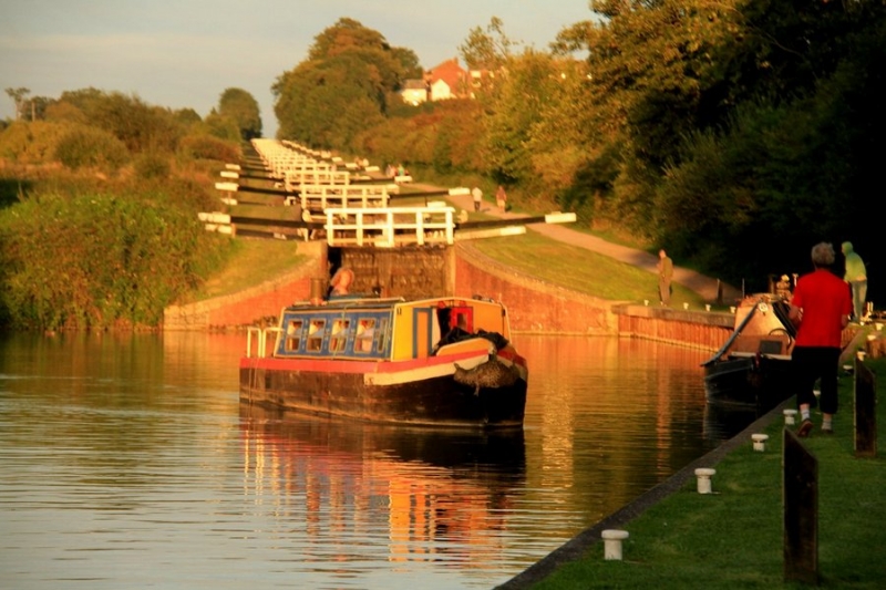
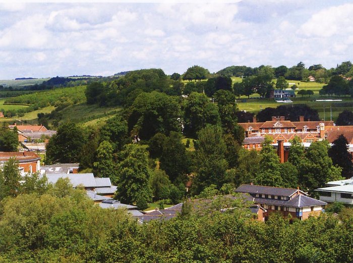 The landscape both in and around Marlborough is a rich archaeological feast which becomes more exciting with every new discovery. The very first evidence of people using the land on which Marlborough now lies stems from a few Palaeolithic hand axes from the site of the gasworks and from Granham Hill, ephemeral proof that hundreds of thousands of years ago people used this area as they followed migratory herds across the landscape.
 Frequent discoveries of brooches, coins and pottery found all over Marlborough are testament to the people of the Iron Age and there are many, many finds left behind by the Romano-British people who lived here shortly afterwards, including a settlement with a cemetery at St. Margaret’s Mead and a Villa at Brown’s Farm. In addition, the famous ‘Cunetio Hoard’. The Saxon period shows little evidence of occupation and archaeological fnds are limited to a few coins and shards of pottery; there was however a Saxon burial located near Savernake Hospital.
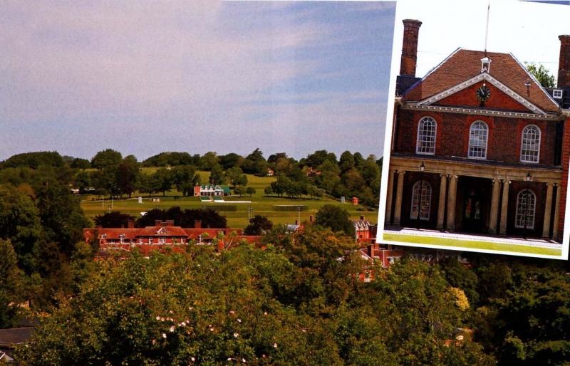 The Castle on the Mound had fallen into disrepair and stones from the building were now being used locally.